Land of the Giants Campground, Mount Field National Park, TAS
After breaky we drove back to Queenstown where we were lucky to see the old steam train leave for its daily tourist journey to Strahan via the West Coast Wilderness Railway. Next we stopped at the Iron Blow Lookout on top of Gormanston Hill, looking over the decommissioned open-cut mine – now filled with emerald water. Not long after we crossed Lake Burbury and drove into Franklin – Gordon Wild Rivers NP. First stop was a short walk to 35m high Nelson Falls (1.4km return – 15min). Next we continued on to Donaghy’s Hill where we had lunch and took a walk to a lookout offering views towards Frenchmans Cap and the Franklin River (2.2km return – 30min). Third stop was at the Franklin River where the Nature Trail took us past the Franklin and Surprise Rivers (1km loop – 10min). Last stop was at King William Saddle providing beautiful views of the surrounding ranges. Afterwards we drove into Derwent Bridge to admire stunning “The Wall in the Wilderness” created by wood sculptor Greg Duncan who’s carving a panorama in wood panels depicting the history of the Tasmanian Highlands. Next we travelled the scenic route to Tarraleah, Ellendale and Westerway to Mount Field NP. Before setting up camp we walked to Russell Falls, Horseshoe Falls and the Tall Trees (1km return -45mins).
 |
| West Coat Wilderness Railway Queenstown |
 |
| Iron Blow Lookout (decommissioned mine) Gormanston |
 |
| Iron Blow Lookout (decommissioned mine) Gormanston |
 |
| Iron Blow Lookout (decommissioned mine) Gormanston |
 |
| Drive towards Lake Burbury bridge |
 |
| Drive towards Lake Burbury bridge |
 |
| Crossing Lake Burbury |
 |
| Lake Burbury Bradshaw Bridge Camping Ground |
 |
| Lake Burbury Bradshaw Bridge Camping Ground |
 |
| Nelson Falls Walk Franklin-Gordon Wild Rivers NP |
 |
| Nelson Falls Franklin-Gordon Wild Rivers NP |
 |
| Drive to Donaghy's Hill Franklin-Gordon Wild Rivers NP |
 |
| Donaghy's Hill Walk Franklin-Gordon Wild Rivers NP |
 |
| Donaghy's Hill Lookout Franklin-Gordon Wild Rivers NP |
 |
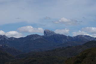
| Frenchmans Cap in the distance - Donaghy's Hill Lookout Franklin-Gordon Wild Rivers NP |
 |
| Frenchmans Cap - Donaghy's Hill Lookout Franklin-Gordon Wild Rivers NP |
 |
| Franklin River Walk Franklin-Gordon Wild Rivers NP |
 |
| Franklin River Franklin-Gordon Wild Rivers NP |
 |
| King William Saddle Franklin-Gordon Wild Rivers NP |
 |
| The Wall - Derwent Bridge |
 |
| Carved by hand from Huon Pine The Wall - Derwent Bridge |
 |
| Drive to Mt Field NP - Derwent Valley |
 |
| Drive to Mt Field NP - Derwent Valley |
 |
| Moo Drive to Mt Field NP |
 |
| Lake Meadowbank - Dunrobin Bridge Drive to Mt Field NP |
 |
| Lake Meadowbank Drive to Mt Field NP |
 |
| Lake Meadowbank Drive to Mt Field NP |
 |
| Russell Falls - Mt Field NP |
 |
| Russell Falls - Mt Field NP |
 |
| Horseshoe Falls - Mt Field NP |
 |
| Mt Field NP |
 |
| Nele measuring the tall trees Mt Field NP |
 |
| Tall Trees Walk - Mt Field NP |
No comments:
Post a Comment